County of Brisbane
Scone is in the County of Brisbane, which was one of nineteen counties in New South Wales approved by Governor Darling for settlement on October 14, 1829.1
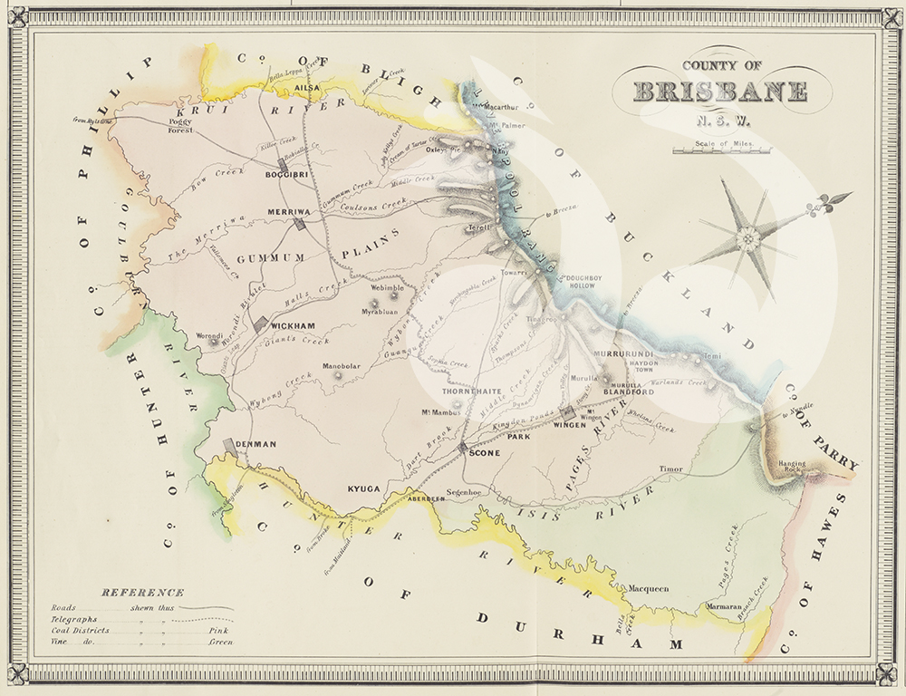
Map of the County of Brisbane courtesy of the National Library of Australia. External reference number: CD-6907996.
The nineteen counties approved by the government for settlement included:2
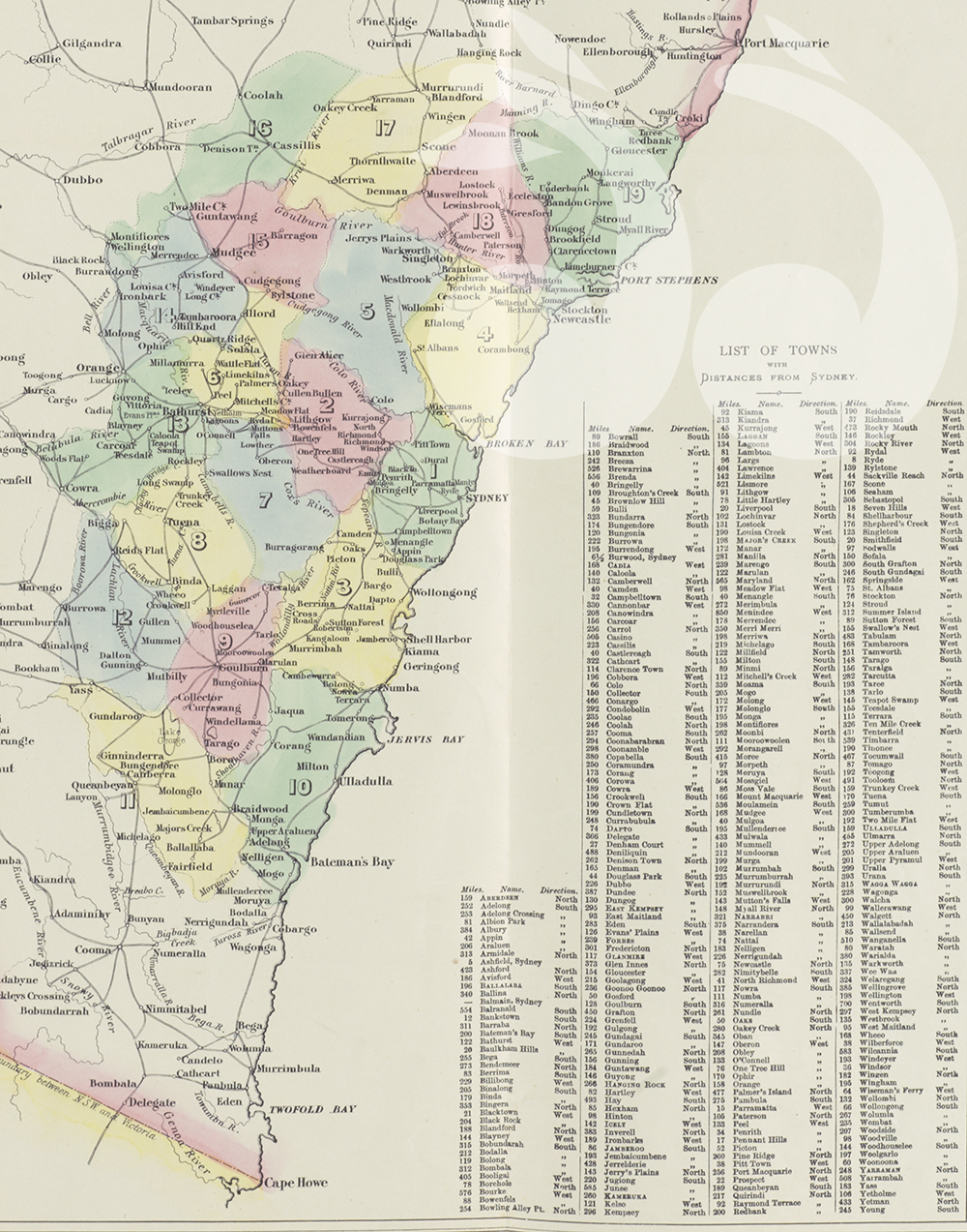
Map of the Counties of NSW in 1829. Courtesy of the National Library of Australia. External reference number: CDC-10510783.
1. Cumberland
2. Cook
3. Camden
4. Northumberland
5. Hunter
6. Roxburgh
7. Westmoreland
8. Georgiana
9. Argyle
10. St Vincent
11. Murray
12. King
13. Bathurst
14. Wellington
15. Phillip
16. Bligh
17. Brisbane
18. Durham
19. Gloucester
Limits of location
Governor Darling had established “limits of location”, meaning people were not allowed to apply for land grants or occupy areas of the colony outside of these boundaries.
Initially two areas were created within the colony by government order on September 5, 1826.3
The details of the initial government order were published in the Sydney Gazette and New South Wales Advertiser, on September 6, 1826:
“The Northern Boundary to be from Cape Hawk, in Line due West to Wellington Valley. The Western Boundary to be the River Macquarie, from Wellington Valley to the 33d Parallel of Latitude: from thence, the Line to be extended to the 148 Degree of East Longitude; and from that Point directly South, until it reaches the River Lachlan; thence due East to Campbell’s River, pursuing the Line of that River to the Southward, and so on to the Latitude of Bateman-bay, which forms the Southern Boundary.”4
The boundaries continued to expand and were adjusted annually by Government Order.
Following the introduction of the 19 counties in 1829, the county of Port Macquarie was added the following year and “after this point the squatters became involved and the ‘limits’ were completely open”.5
There are now more than 141 counties in New South Wales and these counties are divided into 7,459 parishes, which are commonly referred to on land deeds.6
- Historical Background, Squatters and Graziers 1837-49, NSW State Records, cited on May 5, 2015, <https://www.records.nsw.gov.au/state-archieves/indexes-online/indexes-to-land-records/squatters-and-graziers>, viewed on May 22, 2015. [↩]
- Government Order, The Sydney Gazette and New South Wales Advertiser, Saturday, October 17, 1829, p.1. Viewed on Trove, National Library of Australia, cited on May 5, 2015 <http://trove.nla.gov.au/ndp/del/page/497917> [↩]
- Depasturising licences, 1837-46, 1851, NSW State Records, cited on May 5, 2015, <http://www.records.nsw.gov.au/state-archieves/indexes-online/indexes-to-land-records/index-to-depasturising-licences-1837-46-1851> [↩]
- Government Order, The Sydney Gazette and New South Wales Advertiser, Wednesday, September 6, 1826, p.1, viewed on Trove, National Library of Australia, cited on May 5, 2015. <http://trove.nla.gov.au/ndp/del/page/496127> [↩]
- Gordon Beckett, The Enterprising Colonial Economy of New South Wales 1800-1830: being the government business enterprises and their impact on the colonial economy 1788-1830, Trafford Publishing, 15 Aug 2012, p.231. [↩]
- County maps, Archives In Brief 80 – County and parish maps, NSW Records, cited on May 5, 2015. <http://www.records.nsw.gov.au/state-archives/guides-and-finding-aids/archives-in-brief/archives-in-brief-80> [↩]