Town Map of 1836
This is the earliest surviving map of Scone; a plan from 1836. There had already been settlement in the area with the village of Redbank on the west banks of Kingdon Ponds, but there are no surviving maps of the first settlement. There were also people residing to the right of the planned township of Scone, beside the track which became the Great North Road, now the New England Highway. To view more detail, simply click on the map.
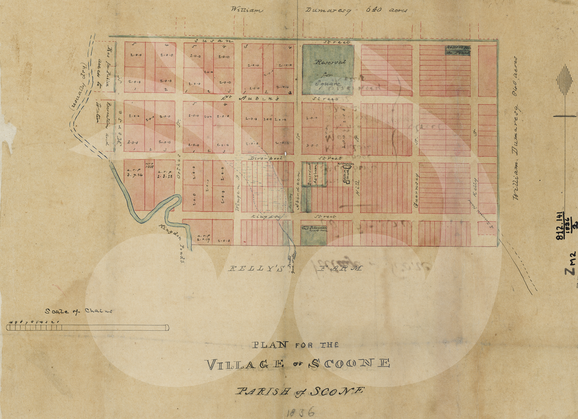
Map of the plan for Scone, 1836. Kindly provided by the NSW State Library.
The first streets of Scone included:
- Aberdeen: Likely to be in reference to the township growing to the south of Scone;
- Guernsey;
- Hill;
- Kelly: Named after Captain Richard Kelly;
- Kingdon: Named after Kingdon Ponds;
- Liverpool;
- Morse;
- Orthes: Named after a battle in 1814;
- St Aubins: Named after a large property to the south of Scone;
- Susan and
- Wingen: An Aboriginal word meaning fire, probably relating to Burning Mountain, which was also later the name of the settlement near the Mountain.